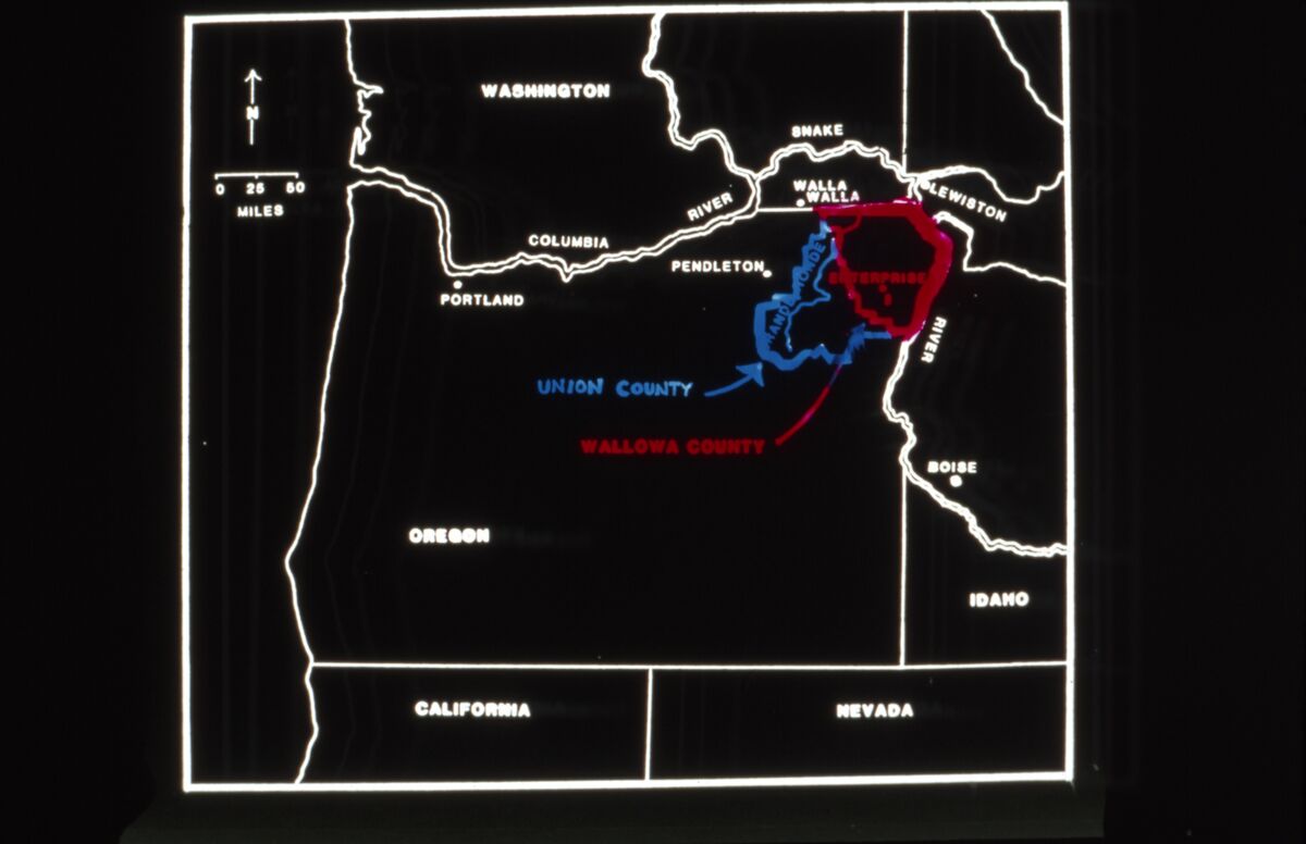
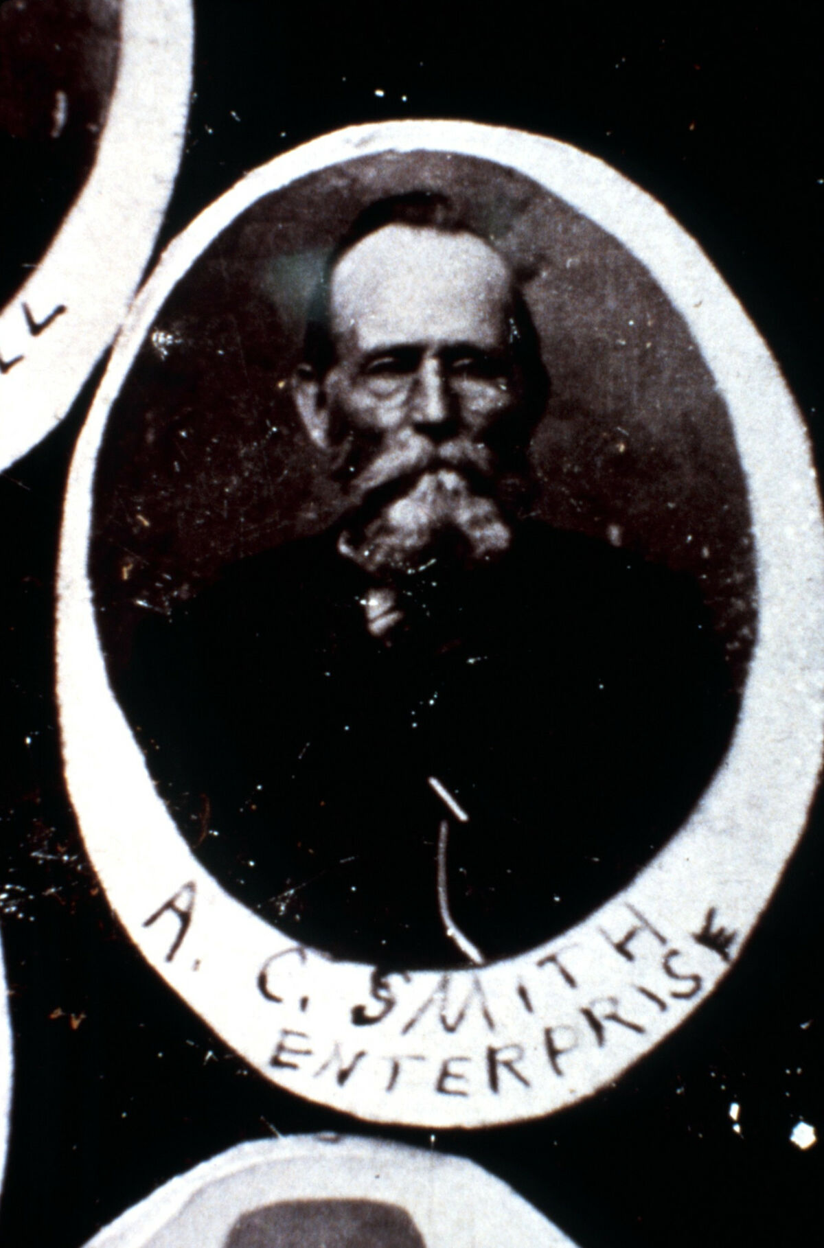
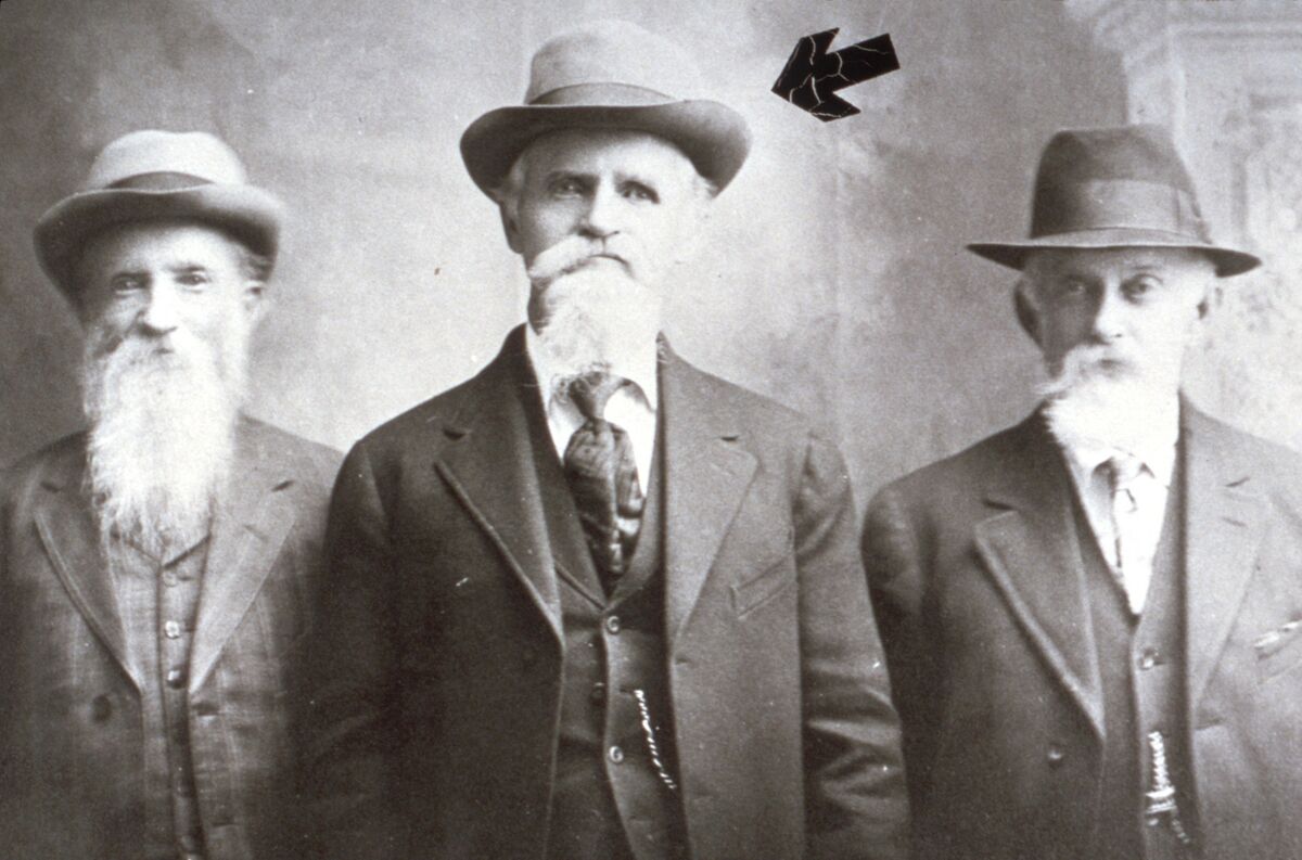
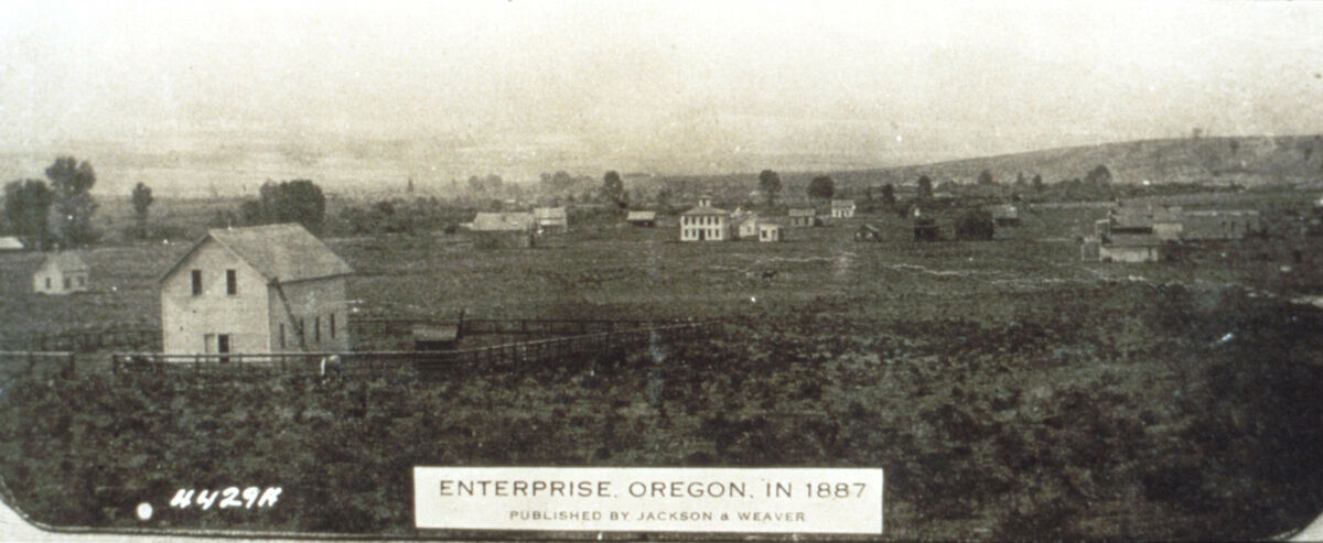
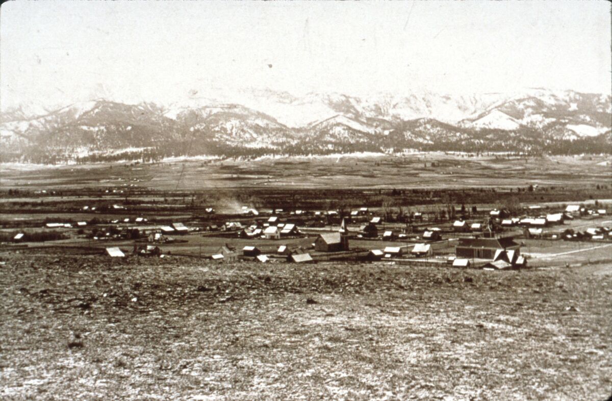
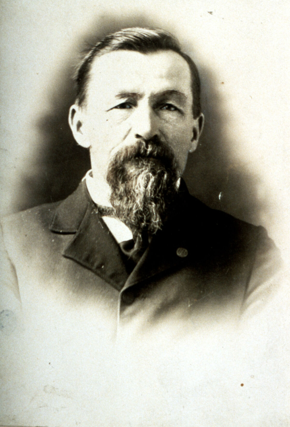
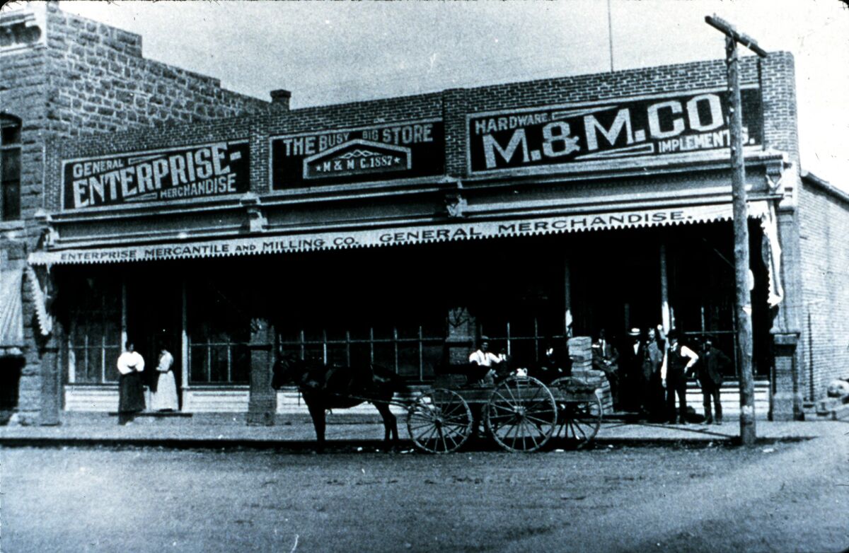
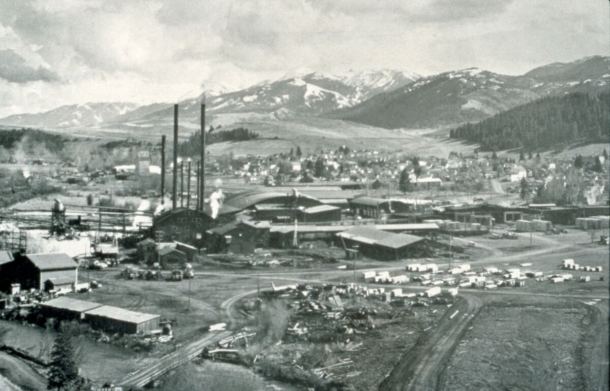
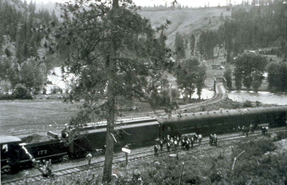
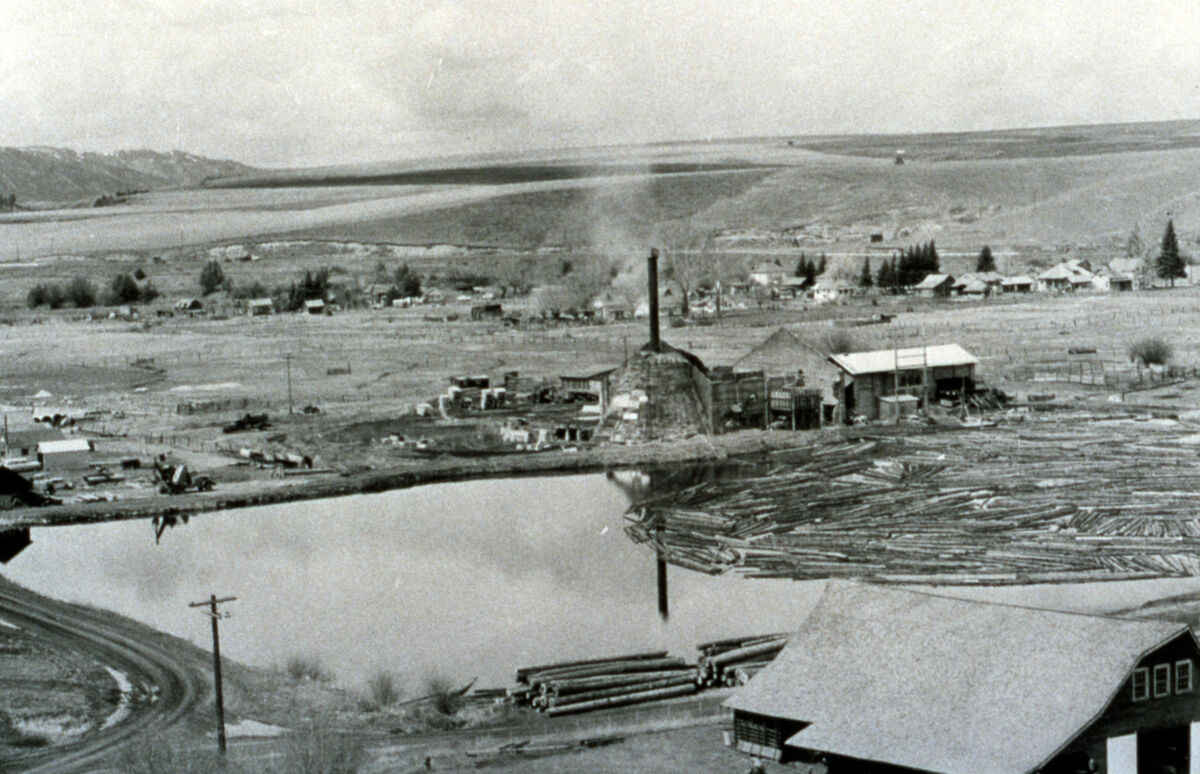
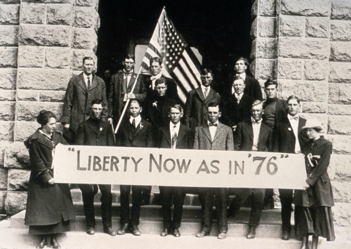
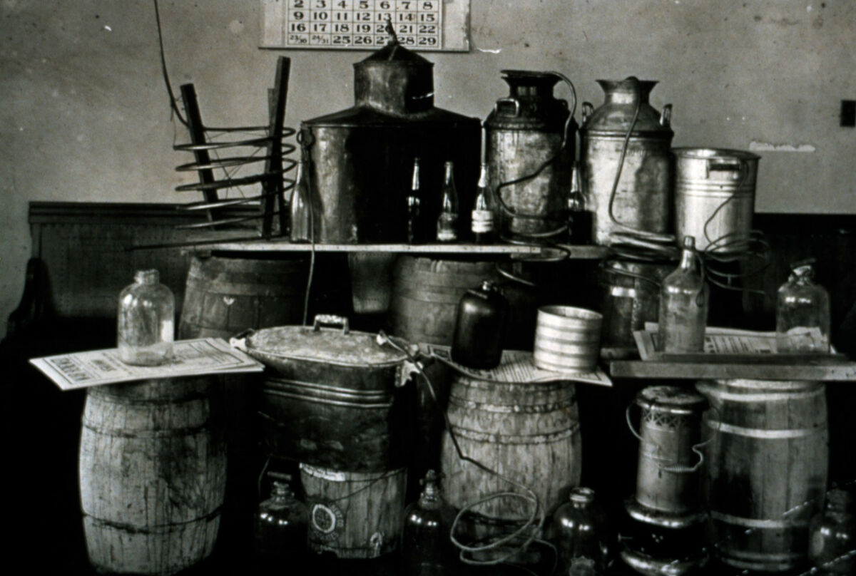
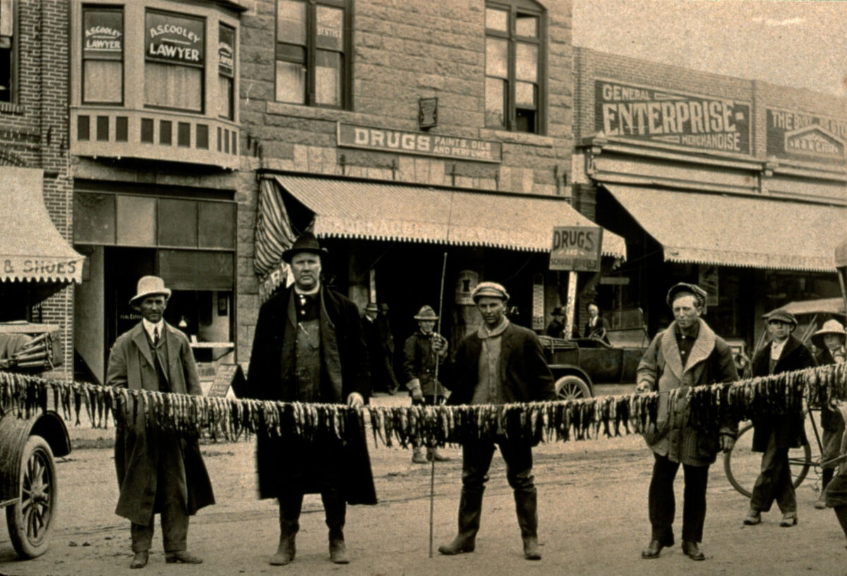
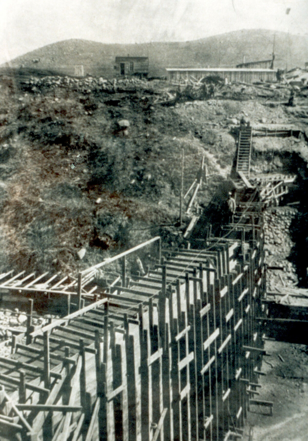
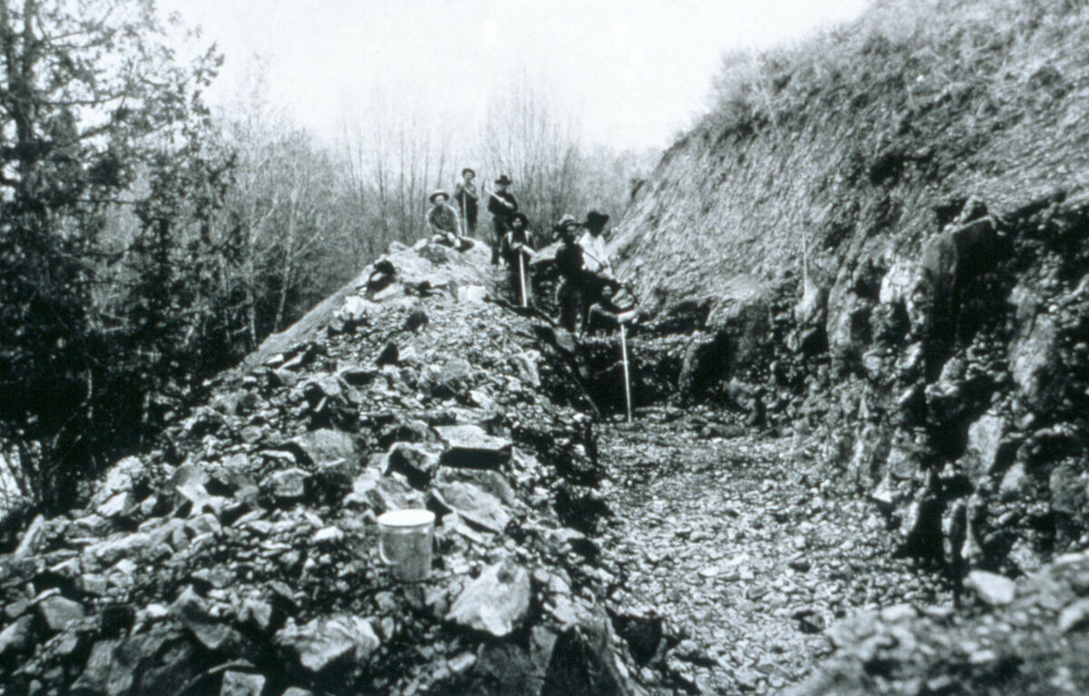
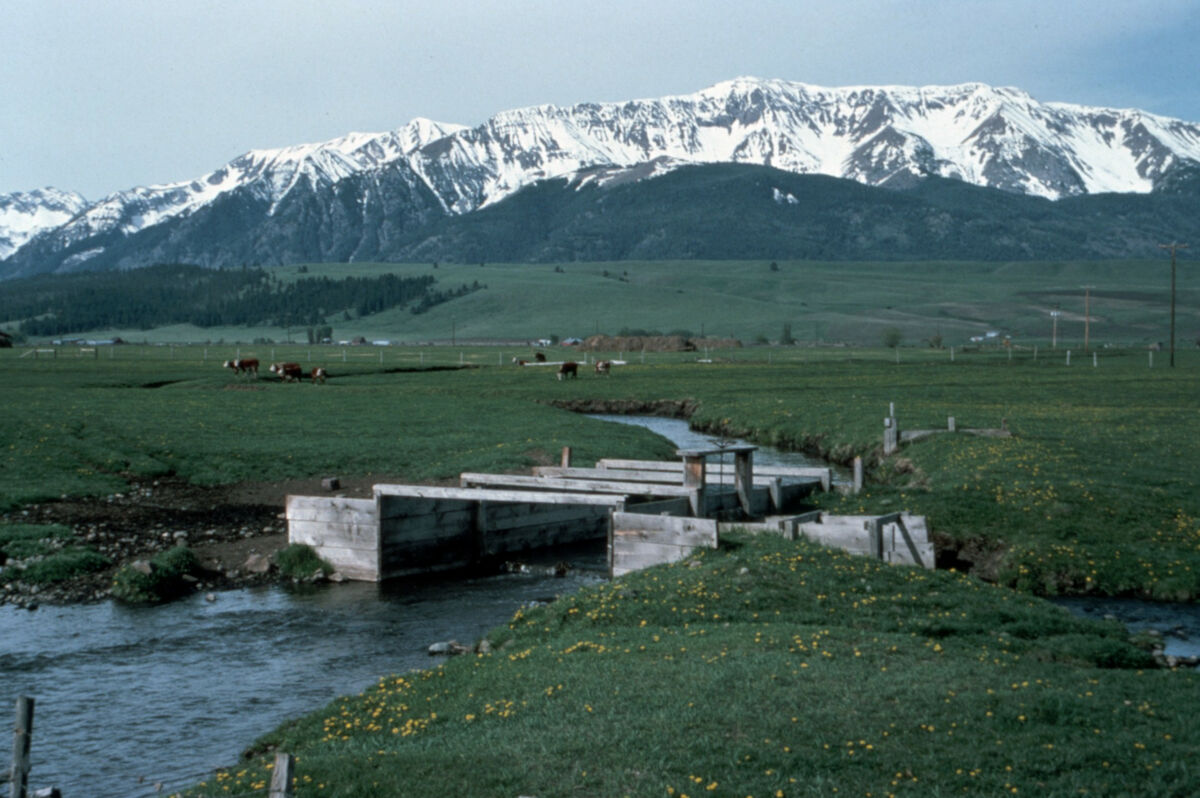
This short film, restored from a narrated slide presentation from 1987, tells the history of Wallowa County, Oregon.
Annotated Slides
The annotations are necessarily incomplete due to poor memory and the passage of time. If you notice errors or misattributed photos, please contact us at info@wallowahistory.org with corrections.
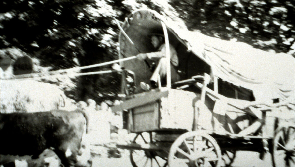
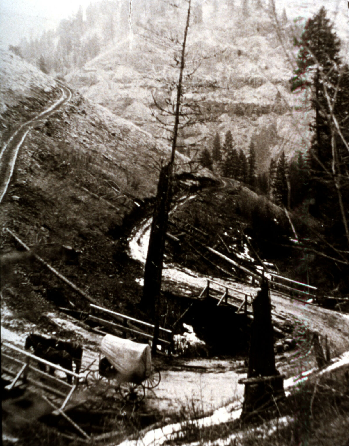
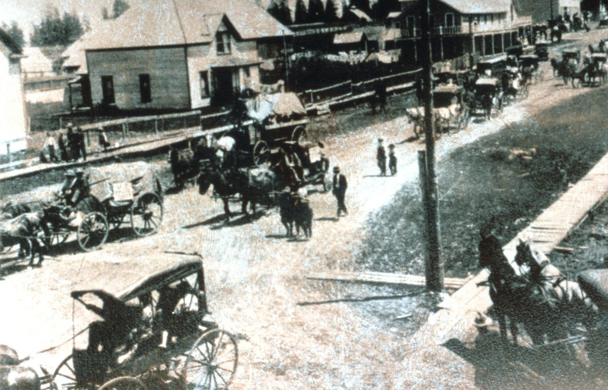
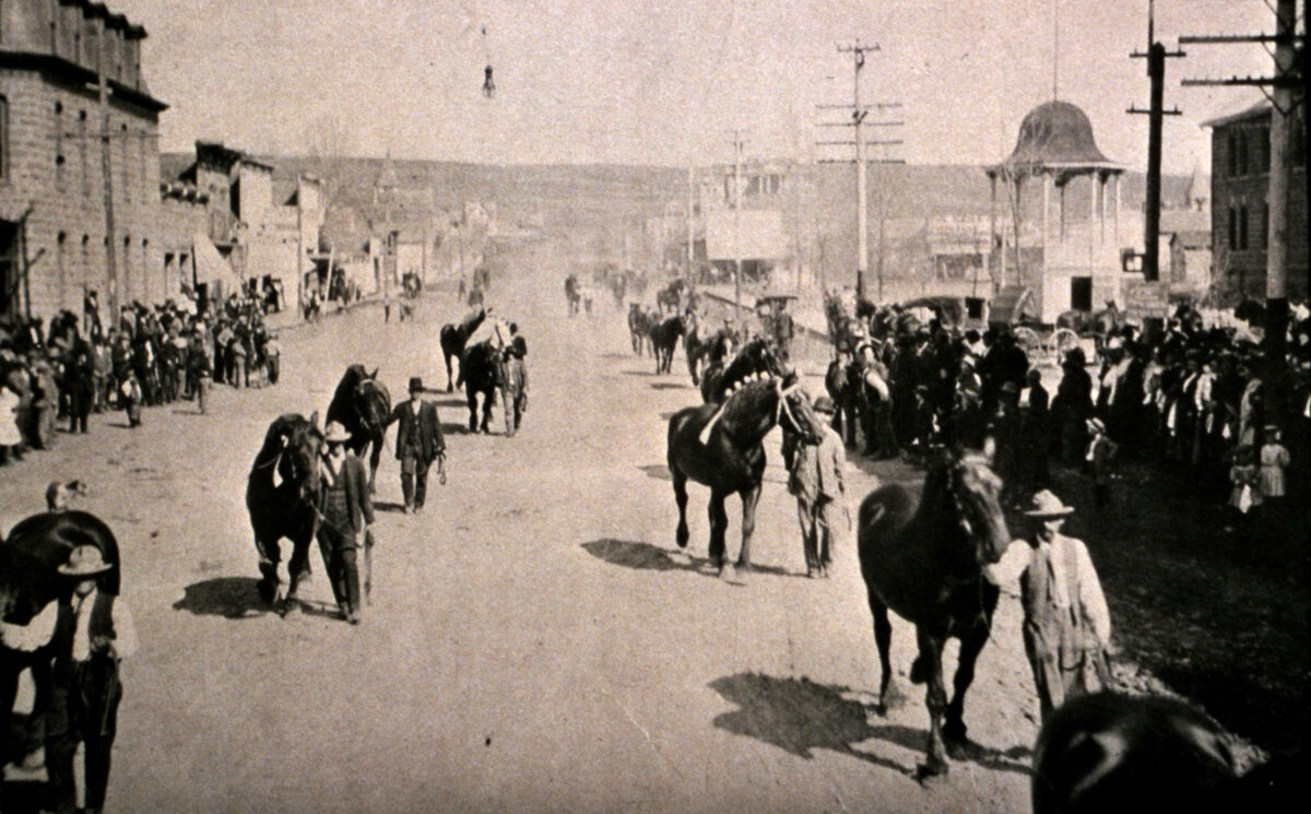
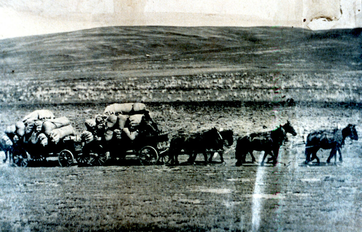
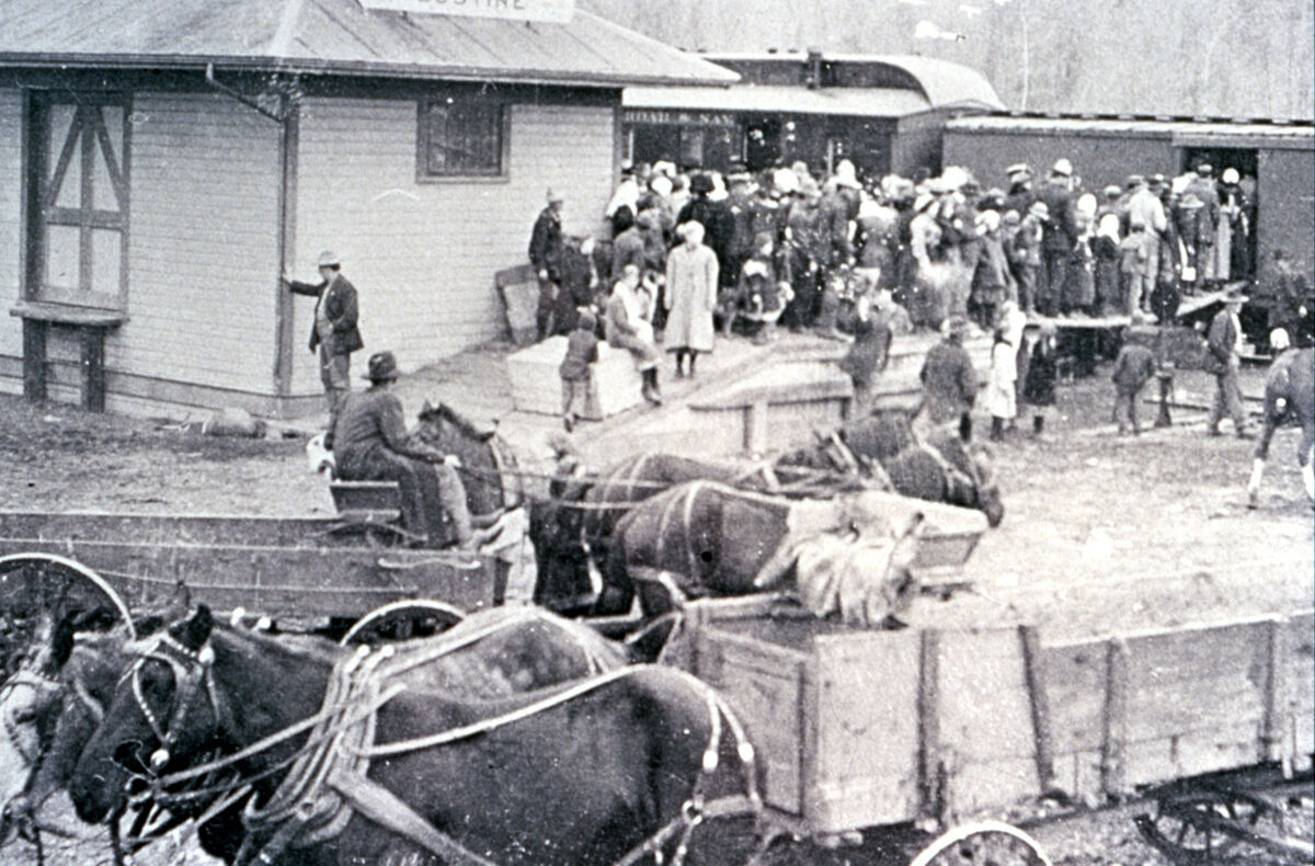
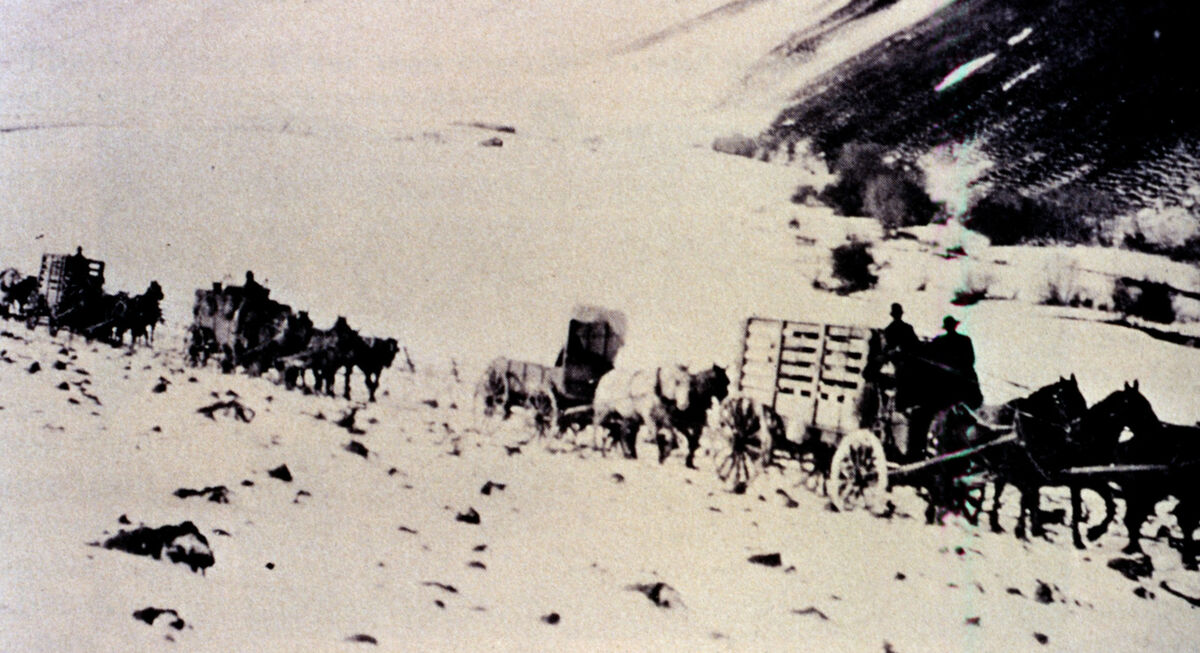
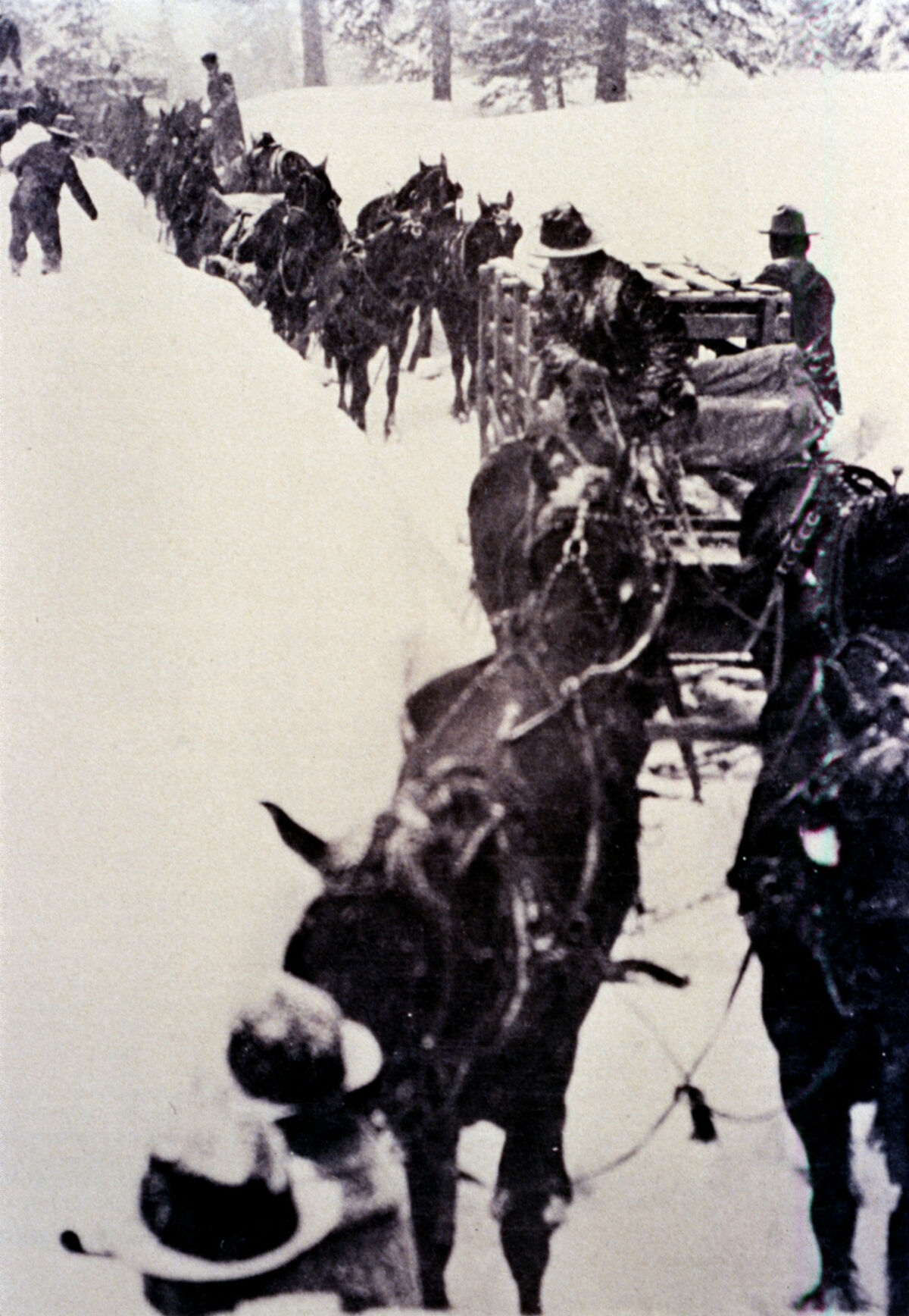
001
Title card. Looking south from Smith Mountain across the lower valley. Taken by Janie Tippett.
002
This field, probably of mustard but possibly an early example of canola in the county, blooms yellow on Upper Prairie Creek. Rising behind the east moraine of Wallowa Lake are, from left, Mt. Howard, Mt. Bonneville, and Chief Joseph Mountain. Taken by Janie Tippett.
003
Taken by Janie Tippett.
004
Taken by Janie Tippett.
005
Middle Point at the confluence of Big Sheep and Little Sheep Creeks, on the highway near Imnaha. Taken by Janie Tippett.
006
Drawing of the Nez Perce fishtraps in use, from the Wallowa County Museum collection.
007
Map showing the centennial boundaries of Wallowa County in 1987.
008
W. “Bill” George tends the fire at a backcountry camp. Taken by Janie Tippett.
009
View looking down into Hells Canyon, from the Wallowa County Museum collection.
010
LeGore Lake, the highest lake in Oregon. Taken by Janie Tippett.
011
Dug Bar on the Snake River in Hells Canyon. Taken by Janie Tippett.
012
Sacagawea Mountain in the Eagle Cap wilderness. Taken by Janie Tippett.
013
The Imnaha drainage. Taken by Janie Tippett.
014
Map showing Oregon Trail and Lewis and Clark Trails that did not penetrate the Wallowa country.
015
Falls Creek waterfall above the Hurricane Creek trail, on the trail to the LeGore Mine and LeGore Lake. Taken by Janie Tippett.
016
Taken by Janie Tippett.
017
Looking southwest across the camas beds on the Lewiston Hwy (Hwy 30) north of Enterprise. Chief Joseph Mountain can be seen in the distance. Taken by Janie Tippett.
018
Courtesy of Grace Bartlett’s book or the Wallowa County Museum. Signed Grende La ...? This is a drawing dated 1978.
019020
Herd of horses along Wallowa Lake, tended to by white settlers.
021
Drawing of Old Chief Joseph, Tuekekas, dated 29 May 1855.
022
Photo of Young Chief Joseph.
023
Photograph of Ollokot, closely cropped from the larger portrait in slide 035, taken in 1877 by Chas. W. Phillips in Walla Walla.
024
Famous drawing of the Treaty of 1855 at Walla Walla, Washington.
025
Drawing of the reservation after the revised Treaty of 1863.
026
Map showing the boundaries of Union County, of which Wallowa County was then a part, and the current boundaries of Wallowa County.
027
A.C. Smith. This is a collection of these photographs of officials possibly related to Grand Army of Republic, from the Civil War. Courtesy of the Wallowa County Museum.
028
James Tulley of the Tulley brothers.
029
View from Smith Mountain. Taken by Janie Tippett.
030
Fanny Johnson and Findley?
031
View from Smith Mountain. Taken by Janie Tippett.
032
Reid Johnson, a descendent of the Johnson family. Taken by Janie Tippett.
033
W.M. McCormack's gravestone in the Alder Slope cemetery. Taken by Janie Tippett.
034
Guy McCormack, descendant of W.M. McCormack. Taken by Janie Tippett.
035
The Library of Congress says of this image, “Caption identifies sitters as Eagle of Light, Nez Perce; Joseph, Nez Perce; and (Smohollah). However, Bill Gulick in Chief Joseph Country: Land of the Nez Perce, 1981, identifies sitters in this image as Billy Carter, Ollokot (Chief Joseph's brother) and Middle Bear.” Further, the photo in slide 023 has cut out a close-section of the middle man and labeled him as Ollokot as well. Taken by Charles W Phillips.
036
At Wallowa Lake, Sarah Jane Knott, daughter of F.C. Bramlet, stands between two unidentified Native men. Sarah Jane was the first white child born in the county.
037
Nez Perce Dreamers in traditional dress before the Flight of 1877.
038
Snake River crossing at Dug Bar. Taken by Janie Tippett.
039
Nez Perce Crossing marker at Dug Bar where the Nez Perce crossed in 1877. Taken by Janie Tippett.
040
This is a filler photo with no significance related to the narrative at this point. The photo is not of near Grangeville, but of somewhere on Little Sheep Highway near the fish hatchery between Joseph and Imnaha. Taken by Janie Tippett.
041
Taken by J. H. Romig.
042043044045
Cy Wilkinson
046
This is one of the few known photographs of Frank Vaughn (far right) taken at McElroy's stable in Wallowa, c. 1900. Vaughn, one of seven Wallowa County men implicated in the murder of 34 Chinese gold miners on the Snake River in 1887, turned state's evidence against the other six.
047
The city of Imnaha, taken around 1910. Taken by Roy Edgemond.
048049
Stanlynn Daugherty, a llama packer, leads Janie Tippett’s 4-H Sourdough Shutterbugs into the backcountry on Forest Service-improved trails. Taken by Janie Tippett.
050
View of Wallowa Lake from the High Wallowas Gondola at Mt. Howard. Taken by Janie Tippett.
051052
Oxen.
053
Alder Slope, looking up at Ruby Peak in the Wallowa Mountains. Taken by Janie Tippett.
054
Double rainbow over Locke’s place on Prairie Creek, looking east towards the breaks of the canyons. Taken by Janie Tippett.
055
A historic barn on the Hutchinson place on Prairie Creek, the first homestead granted in Wallowa County. Taken by Janie Tippett.
056057
Sled Springs?
058059
The town of Wallowa.
060
Possibly the Zumwalt or Crow Creek roads.
061
Minam Grade. S.E. Smith.
062063
Drawing of the town of Alder.
064
The town of Joseph.
065
Portrait of F.D. McCully, the founder of the town of Joseph.
066
McCully’s mercantile in Joseph.
067068
Joseph with its extra-wide streets, patterned after McCully's home town of Salem, Oregon.
069
Before death on Colville.
070071
Fine Hotel.
072
The first issue of the Wallowa Chieftain was published in Joseph, at the time a town in Union County, on May 15, 1884.
073
Patent sheets were bought by newspaper publishers with one blank side for local news and one side covered in advertisements, often for patent medicines.
074
The First Bank of Joseph is still the oldest original structure in Joseph. It is now occupied by the Wallowa County Museum.
075
Lostine. Postcard.
076
Wallowa after 1910.
077
Enterprise, Oregon, in 1887. Published by Jackson & Weaver.
078
Enterprise.
079
Robert Stubblefield. Taken by Janie Tippett.
080081082
Taken by Steve Roundy.
083084
Keltner Hardware.
085
1910.
086
This is a classic photo associated with the spring of '87 and the birth of Enterprise. According to Janie Tippett, who researched his life, the Chinese man at far left, Wong, homesteaded up Dorrance Gulch and lived in a little shack called “Wong’s Shack”. He was picked on and discriminated against.
087
Wallowa County Courthouse in Enterprise, Oregon.
088
Wallowa County Courthouse in 1987. Taken by Janie Tippett.
089
The famous J. Bowlby building in Enterprise, constructed of local Bowlby stone in 1899. It was for a time the Wagner’s Men’s Store, then the much-loved Lear’s Restaurant, and now the building is home to local arts organization, Fishtrap. Taken by Janie Tippett.
090
Constructed of Bowlby stone, this building in Enterprise has been the Wallowa County High School, the hospital, and guest apartments. Janie Tippett remembers a nurse riding her bike from Wallowa to work every day. This is the same building as in slide 229. Taken by Janie Tippett.
091092
One of very few photos of the town of Paradise.
093
Eureka Bar, the site of a short-lived copper mining town at the confluence of the Imnaha and Snake Rivers. The area has superb steelhead fishing. Slide 098 shows the stamp mill. Taken by Janie Tippett.
094
Mining cabin in the Wallowas. Photographer is unknown.
095
The LeGore brothers at their mine, courtesy of W. “Bill” George.
096
One of the LeGore brothers, possibly Joe, at his mine. Courtesy of W. “Bill” George.
097
Certificate for the ownership of shares from the Wallowa Silver Mining and Tunnelling Company.
098
The stamp mill at Eureka Bar, uphill from slide 093.
099
Caption reads, “Passing Joseph Sept [?] Enroute to the Tenderfoot Mining Camp, loaded with machinery for the [20?] stamp mill.“ The Tenderfoot Mine was "salted with gold" to fool investors.
100
Taken from Hwy 82 near Fish Hatchery Road. Steve Roundy added the arrows pointing to the Quarry and Plantsite for the mining of black marble. The gap just to the right of the Quarry arrow is Murray Gap. Photo is from the Wallowa County Museum.
101
Ink drawing of the Black Marble and Lime Company mill and offices below Ruby Peak on Alder Slope. Date unknown. Courtesy of the Wallowa County Museum.
102
Black Marble Lime Company exhibit arranged and photographed by Steve Roundy.
103
Early print advertisement for the Black Marble and Lime Company. Courtesy of the Wallowa County Museum.
104
A black marble kiln on Alder Slope, west of Enterprise. Taken by Janie Tippett.
105
Intended to evoke the glacial action that carved Wallowa Lake. Taken by Janie Tippett.
106
Victor
107108109110111112113114115116117118119120
The M. J. G. Ranch, Wallowa County’s first dude ranch, operated out of this building at Wallowa Lake, near the Wallowa Lake Wonderland.
121122
Rope tow up Ski Run Rd, above the Buhler Ranch near Chief Joseph Mountain. Taken by Janie Tippett.
123
Cabin Creek Stock Farm.
124
Refreshments at the Round-Up
125
Janie Tippett remembers this photo from the Enterprise Record Chieftain’s anniversary issue. The original photo may have been taken in or around 1910.
126
An early homestead on Hurricane Creek? Similar image from negatives 1902.
127
A logging camp in the forest. Possibly the caboose cabins at Maxville.
128
Chickens at the Tippett home place on Prairie Creek. Taken by Janie Tippett.
129
A milk cow at the Tippett home place on Prairie Creek. Taken by Janie Tippett.
130
The Tippett place in the hills at Wet Salmon Creek. Taken by Janie Tippett.
131
Grass: the number one ingredient in stock-raising. Taken by Janie Tippett.
132
This old homestead cabin shows the way settlers chinked with moss and covered the roof in hand-hewn shakes. Taken by Cressie Green.
133
An old homestead on the lower Imnaha River. Taken by Janie Tippett.
134
Possibly taken by Cressie Green.
135
An example of an old bar, possibly taken by Cressie Green.
136
Alphon Courtney’s “Round Barn,” a dairy barn built on Warnock Road just outside of Lostine, circa 1925. According to Janie Tippett, “Inside, all nicely laid out, was the milking parlor, which could accommodate 24 milk cows, with stantions and gutter going around in circular fashion. The north side of the barn housed the work horses and the stalls were there. The separator room was located on the eastern side. Here the milk was separated into skim ilk an cream. The silo, being in the center, held the silage that was fed to the cows. There was also a hayloft upstairs.” Taken by Janie Tippett.
137
The Wilson Barn on Wilson Lane, an example of a modern dairy barn at the time of its construction, is still standing in 2022. Taken by Janie Tippett.
138
As of 2022, Triple Creek Ranch now owns this iconic octagonal barn on upper Prairie Creek. Taken by Janie Tippett.
139
A classic barn on Hurricane Creek. Francis Buckles owns it as of 2022, and the barn is still in good shape. Taken by Janie Tippett.
140
Intermission card to be displayed while the first and second slide carousels were swapped out in the Kodak projector. Taken by Janie Tippett.
141142143
Dug Bar on the Snake River in Hells Canyon. Taken by Janie Tippett.
144145
The Lower Imnaha Trail below Cow Creek, above Eureka Bar. Taken by Janie Tippett.
146
Photo taken upstream from Dug Bar on the Snake River, not far from the site of the Deep Creek massacre of Chinese miners. This is a cropped version of slide 261. Taken by Janie Tippett.
147
Chesnimnus country.
148149150
Wearing Janie Tippett’s clothes and hat, good friend Eileen Potter poses with a butter churn from the Wallowa County Museum. Taken by Janie Tippett.
151
Registered Jersey dairy cows grazing in front of the Wilson house on Wilson Lane below Ruby Peak on Alder Slope.
152
Hog farm.
153
A sow heading for the trough. Taken by Cressie Green.
154155
Todd Nash sits on a classic example of an early fence. Taken by Janie Tippett.
156
The Tippett place in the hills on 3,000 acres at Wet Salmon Creek. Taken by Janie Tippett.
157158
The photo is included to show the people of Imnaha as they were at the time just after settling, when they would have been bringing produce out to fairs in Wallowa and Union Counties.
159160161162
Judging a 4-H sheep at the Wallowa County Fair in the 1980s. Taken by Janie Tippett.
163164
Courtesy of the U.S. Forest Service.
165
Buhler Ranch in the foreground, with Hurricane Creek behind. Taken by Janie Tippett.
166167
Sheep in a pen. Taken by Cressie Green.
168
Cowboys and cattle at a branding on Corral Creek. Taken by Janie Tippett.
169170171172
Separators during harvest time in the Leap country.
173
A swing-pole derrick lifts the hay bales.
174175
Rolled hay bales. Taken by Janie Tippett.
176
Farms in what looks like the North End. Taken by Cressie Green.
177
Larry Bacon, the son of Spencer Bacon. Larry’s grandfather, Lorenzo Bacon, homesteaded and built his first cabin on Lost Prairie in 1884. Taken by Janie Tippett.
178
Raising turkeys.
179
Janie Tippett’s garden at the Tippett home place on Prairie Creek. Taken by Janie Tippett.
180
Doug Tippett sorts seed potatoes at the Tippett home place on Prairie Creek. Taken by Janie Tippett.
181
Dryland wheat fields on the North End. Taken by Cressie Green.
182
Impressive pile of rocks farmers had to remove by hand to be able to farm their fields. Taken by Janie Tippett.
183
Grist mill.
184
Upper Prairie Creek.Courtesy of Max Gorsline.
185
Chesnimnus country.
186187188189190
Pete’s Pond in Enterprise.
191192193194195196197198199
Camp 5 was a temporary logging camp built by the Palmer Lumber Company in the 1910s near Howard Creek and Maxville. It was sold to Bowman-Hicks Lumber Company in 1922. Taken by Janie Tippett.
200
Site of Maxville, a more permanent logging town built in 1923 on the Promise Road north of Wallowa. Taken by Janie Tippett.
201202203204205
Railroad spike symbolizing the end of railroad logging in the Wallowa country. Taken by Steve Roundy.
206207
The Wallowa Mill near the Minam canyon in the lower valley. A second mill was in operation near the current-day powwow grounds at Tick Hill. Taken by Janie Tippett.
208
Boise-Cascade Mill in Joseph. Taken by Janie Tippett.
209210
Farming in the Promise country. Taken by Cressie Green.
211
This barn was included to represent the Leap country. Taken by Cressie Green.
212
The city of Joseph in 1987. Taken by Janie Tippett.
213
Patriotic fervor swept the county in the lead-up to World War I.
214
Ralph “Mose” Tippett’s moonshine still at Corral Creek. This was the bootleg liquor that killed more than one man in the county.
215216217
Possibly taken in the North Minam Meadows, this photo was meant to represent an elk herd in the high mountain meadows of the Wallowas. Taken by Janie Tippett.
218
“Bill Taft” the elk, grazing near Wallowa Lake, one of fifteen elk that were reintroduced to the country from Jackson Hole, Wyoming.
219
“Bill Taft” and another reintroduced elk near Wallowa Lake.
220
Children feed deer at Wallowa Lake. Courtesy of the Wallowa County Museum.
221
A mature bull elk grazing. Taken by Steve Roundy.
222223224
Workers blast and hand-dig the first irrigation ditches in Wallowa County.
225
Silver Lake Ditch carries water from Wallowa Lake to the farms along Tenderfoot Valley Road on Prairie Creek. Taken by Janie Tippett.
226
Sockeye salmon, called Kokanee as they are now land-locked by the dam at Wallowa Lake and no longer swim to the ocean, turn a vibrant red when they spawn. Possibly taken by Steve Roundy.
227228229
This is the same building as in slide 090. The building is no longer standing.
230231232233
An issue of the Enterprise Record Chieftain from Thursday, January 16, 1930.
234
The Imnaha crew of the Civilian Conservation Corps (CCC). Max Gorsline stands fifth from left in a hat. Courtesy of Max Gorsline.
235236
This is now Goebel's gas station in Wallowa.
237
What remains of the site of the rodeo that would become the Chief Joseph Days rodeo, in a swale near Wallowa Lake. None of the structures are still standing in 2022. Taken by Janie Tippett.
238
Chief Joseph Days court. Taken by Janie Tippett.
239240
Carlyle Roundy, the Grand Marshal, rides his horse in the Chief Joseph Days parade through the town of Joseph. Taken by Janie Tippett.
241242243244
Wallowa Lake State Park road sign on the highway on the east side of Wallowa Lake. Taken by Janie Tippett.
245
The view from the High Wallowas Gondola leading up to Mt. Howard, looking northwest across Wallowa Lake. As of 2022, the tram is still a very popular tourist attraction. Taken by Janie Tippett.
246
The Lick Creek trailhead sign in the Wallowa-Whitman National Forest. Taken by Janie Tippett.
247
Max Gorsline adjusts his horse’s pack before hitting the trail to Lick Creek in the Wallowa-Whitman National Forest. Taken by Janie Tippett.
248
Wallowa County celebrates Bavarian and Swiss culture in the annual Alpenfest celebration. Taken by Janie Tippett.
249
Bob Casey drives a team of mules in the annual Hells Canyon Mule Days parade. Taken by Janie Tippett.
250
The town of Wallowa puts on a popular 4th of July parade. Taken by Janie Tippett.
251
The town of Lostine used to host an annual flea market that was very well-attended by locals from all over the county. Taken by Janie Tippett.
252
Courtesy of the U.S. Forest Service.
253
The view from Hat Point. Taken by Janie Tippett.
254
Rafters floating the Snake River. Courtesy of Jim Steen.
255
Ted Juve throws pots for Olaf Pottery. Taken by Janie Tippett.
256
Casting at the Valley Bronze foundry. Taken by Steve Roundy.
257
Putting the finishing touches on a bronze statue at the Valley Bronze foundry. Taken by Steve Roundy.
258
Gallery showing of local artists at the Wallowa Valley Festival of the Arts. Taken by Janie Tippett.
259
The town of Troy on the Grand Ronde River, in the north end of the county.
260
The Wallowa Mountains from Sheep Creek Hill, just as you come out “on top” from the canyons on the Joseph-Imnaha Highway. Taken by Janie Tippett.
261
Photo taken upstream from Dug Bar on the Snake River, not far from the site of the Deep Creek massacre of Chinese miners. This is the full-size version of slide 146. Taken by Janie Tippett.
262
An aging barn in the Elk Mountain area. Taken by Cressie Green.
263
Horses grazing on the Divide. Taken by Janie Tippett.
264
Lost Prairie cemetery. Taken by Janie Tippett.
265
Flora cemetery. Taken by Janie Tippett.
266
The Wallowa County Pioneers arch at the Wallowa County Courthouse in Enterprise. Taken by Janie Tippett.
267
Jackie and Bill Matthews, and their children, Buck and Mona Lee, stand in the barn at the Tippett place at Dug Bar on the Snake River. Taken by Janie Tippett.
268
A homestead on the lower Imnaha River. Taken by Janie Tippett.
269
Three of Janie Tippett’s 4-H Sourdough Shutterbugs eat lunch on boulders atop Wallowa Lake’s east moraine. From left are unknown, Becky Jones, and Amy Zollman. Taken by Janie Tippett.
270
This shot of horses grazing was taken with a zoom lens on the Tippett home place on Prairie Creek. Taken by Janie Tippett.
271
The Himmelwright barn stands with Hurricane Creek in the background. Taken by Janie Tippett.
272
Max Gorsline and Doug Tippett ride on Boner Flat. Taken by Janie Tippett.
273
Sarah and Mike Hale stand with their children, Prairie Rose, Gabe, and Zeke, in the Pioneers arch at the Wallowa County Courthouse in Enterprise. Taken by Janie Tippett.
274
Dave and Mona Glauss ride on the lower Imnaha near Horse Creek. Taken by Janie Tippett.
275
Janie Tippett’s 4-H Sourdough Shutterbugs are reflected in Kinney Lake on Upper Prairie Creek. From left are Willie Zollman, an unknown Johnson, Eric Johnson, and Ryan Hook. Taken by Janie Tippett.
276
Stained glass in the historic Methodist church in Joseph. Taken by Janie Tippett.
277
Carl and Karen Patton’s wedding rickshaw. Taken by Janie Tippett.
278
One of the beautiful sunsets common in Wallowa County. Taken by Janie Tippett.
279
End credits. Steve Roundy organized the music that plays over this section.